GOESSEL, KS
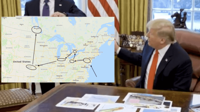
Residents of the small Mennonite town of Goessel, Kansas were on high alert this week after President Trump presented a map showing that a hurricane was apparently heading straight in their direction.
“If you look at the map, it narrowly misses Harrisonburg, Virginia, then heads on up to Lancaster county before taking out Holmes county, Kitchener-Waterloo and Elkhart county and winds up in Kansas and Manitoba,” said meteorologist Al Urkaun. “I’ve never seen anything like it. It’s like this hurricane has a mind of its own or something.”
It’s not yet known what is causing this strange route, but Urkaun believes it may be the work of long time Anabaptist rivals and persecutors, the Calvinists.
“Of course they’ll just say the path of this hurricane was all pre-destined,” said Urkaun. “But, come on, now, this route seems pretty fishy to me.”
Skeptics have suggested it’s highly unlikely a hurricane would stray so far inland, but, then again, with climate change, who the heck knows.
“I’m not taking any chances,” said Mrs. Janzen of Goessel. “As the pastor always says, a Sharpie never lies.”
Thousands of Mennonites have been fleeing to Fresno, while others have gone to Abbotsford or way up north to La Crete, Alberta, seemingly the only locations safe from the hurricane’s wrath.


